File:OCHA map Al-Bustan Silwan 2009.jpg
Jump to navigation
Jump to search
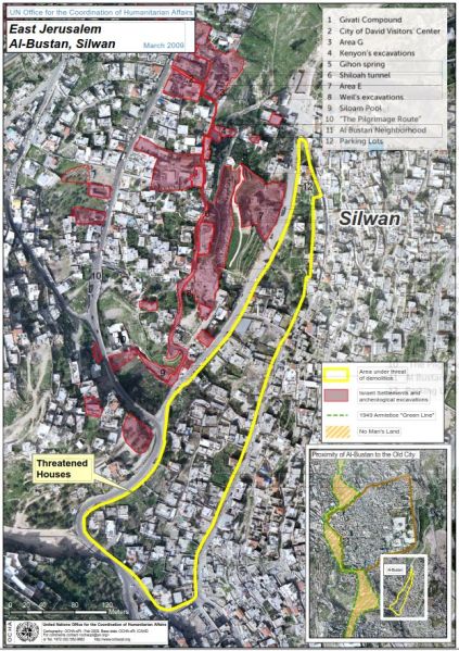
Size of this preview: 423 × 599 pixels. Other resolutions: 169 × 240 pixels | 623 × 882 pixels.
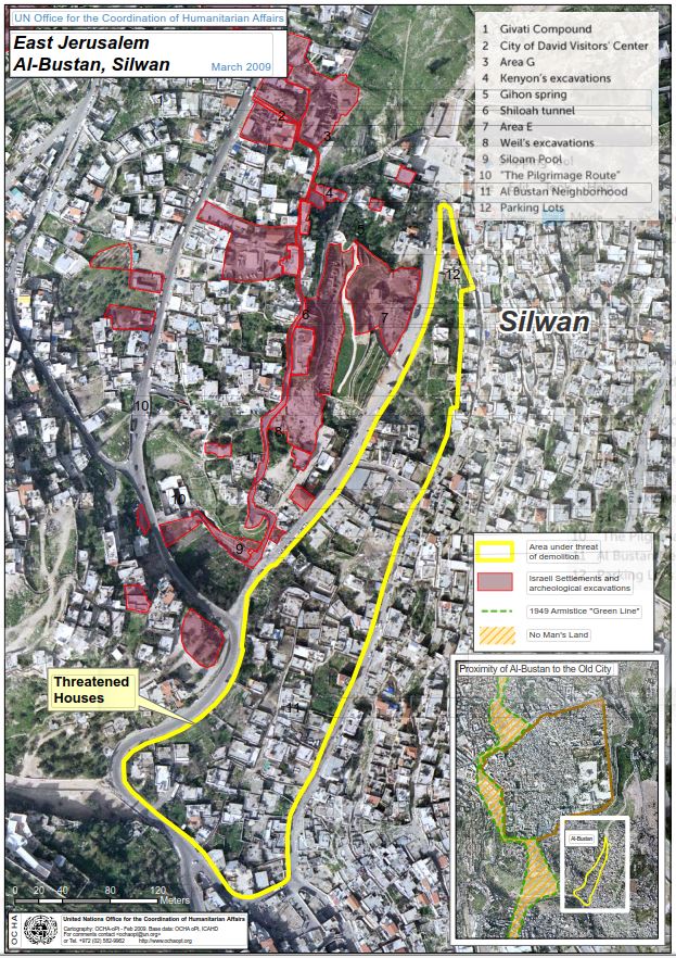
Original file (623 × 882 pixels, file size: 216 KB, MIME type: image/jpeg)
Summary
| Description | UN OCHA oPt map (March 2009) of Israeli settlement and archaeological excavation sites in Silwan, East Jerusalem, including the City of David Visitors' Center and the Givati compound. |
|---|---|
| Commons description | OCHA UN file showing Israeli settlement and archaeological sites in Silwan, East Jerusalem |
| Source | Wikimedia Commons: File:Israeli settlements and archaeological excavavations in Silwan, East Jerusalem.jpg |
| Date | 2021-07-16 15:42:40 |
| Author | OCHA |
| Licence | CC BY-SA 4.0 – https://creativecommons.org/licenses/by-sa/4.0 |
| Attribution | Author: OCHA, via Wikimedia Commons |
| Used on | UK Friends of the City of David |

Creative Commons Attribution-Share Alike 4.0. Retrieved from Wikimedia Commons on 2026-10-20; licence checked against the Commons file page's extmetadata at upload time.
File history
Click on a date/time to view the file as it appeared at that time.
| Date/Time | Thumbnail | Dimensions | User | Comment | |
|---|---|---|---|---|---|
| current | 15:47, 20 October 2026 | | 623 × 882 (216 KB) | Israel Charity Bot (talk | contribs) | Freely licensed image from Wikimedia Commons (CC BY-SA 4.0) |
You cannot overwrite this file.
File usage
The following page uses this file:
